
Monday, June 29th, 2026
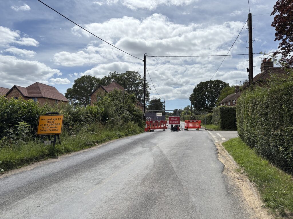
UPDATE: As of 5th September, the road has re-opened.
Until the beginning of September, Bressenden is only accessible from the east side (from the direction of Biddenden). You will not be able to reach Bressenden from the west (Benenden). You will also not be able to drive directly from Bressenden up to Benenden Hospital during this time as road works are taking place from Mockbeggar Lane (see photo above) to Green Lane.
To get to the hospital by car, follow the yellow diversion signs along the circular route indicated with a dashed blue line on the map below. Please do not attempt to drive south along Frog’s Hole Lane and then north along Green Lane, which your SatNav may suggest as an alternative. This route will take you down extremely narrow, single-track lanes with no verges, tall scratchy hedges, very few passing places and some deeply concealed ditches, not to mention two bridges crossing a stream. These lanes are full of deep potholes, and long stretches of steeply broken-off tarmac road edges have made the drivable surface even narrower. To make matters worse, local drivers, as well as trades and delivery vans, will be using these lanes, so there will be a high chance of meeting on-coming traffic and having to reverse some distance. You could end up with two wheels in a ditch or, worse, your car on its side, and you won’t get there any quicker than you would by following the diversion signs. I tried that shortcut on a Sunday when there was little traffic and after meeting three vehicles, and passing them with difficulty, decided never to repeat the experiment.
The map below shows the location of the closed section (the closed stretch is marked with two no-entry signs above the word “Hospital”). If you booked a taxi, please show this map to your driver. Allow 15 minutes to get from Bressenden to the hospital instead of the usual 2 minutes! Whether you are arriving at Bressenden or leaving, in each case your travel must be from/to the crossroads to the east of us (the right-hand side of map, where North is at the top). Ignore any “road closed ahead” signs at the crossroads and near us. We’re the second house on the right after the crossroads going west.
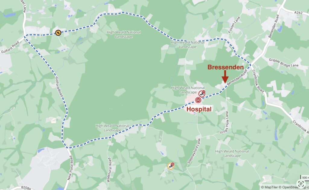
Route from Bressenden to Benenden Hospital until September 2026